- 24/10/2025
- Tags: villages of Mustang
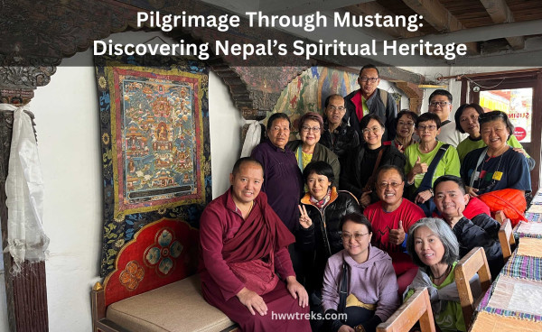
- Himalayan Wander Walkers
Villages of Upper Mustang
Mustang lies behind the High Himalayas in the northern part of western Nepal. It is geographically, culturally, ethically, and religiously closer to Tibet than to other parts of Nepal. The Mustang district can be known for two kinds, namely Upper Mustang and Lower Mustang. All the villages to the north of Kagbeni belong to Upper Mustang. A special permit (USD 500 per person for 10 days) is required for every foreigner to visit the upper region of Mustang. Locally, Upper Mustang is known for “Lo Tsho Dyun,” which means seven valleys in Tibetan.
Upper Mustang was ruled by Mustang Raja (Lo Gyalpo) since the 13th century by Ama Pal (the first Lo King) until 2008 AD. The Lo King lost his royal title when Nepal became a republican country after the centuries-old monarchy. Upper Mustang consists of the following villages: Lo Tsho Dyun consists of 33 villages in total, which are explained briefly below without missing even a very small village with a single house.
Contents [hide]
1. Most popular villages of Upper Mustang
I. Lo Manthang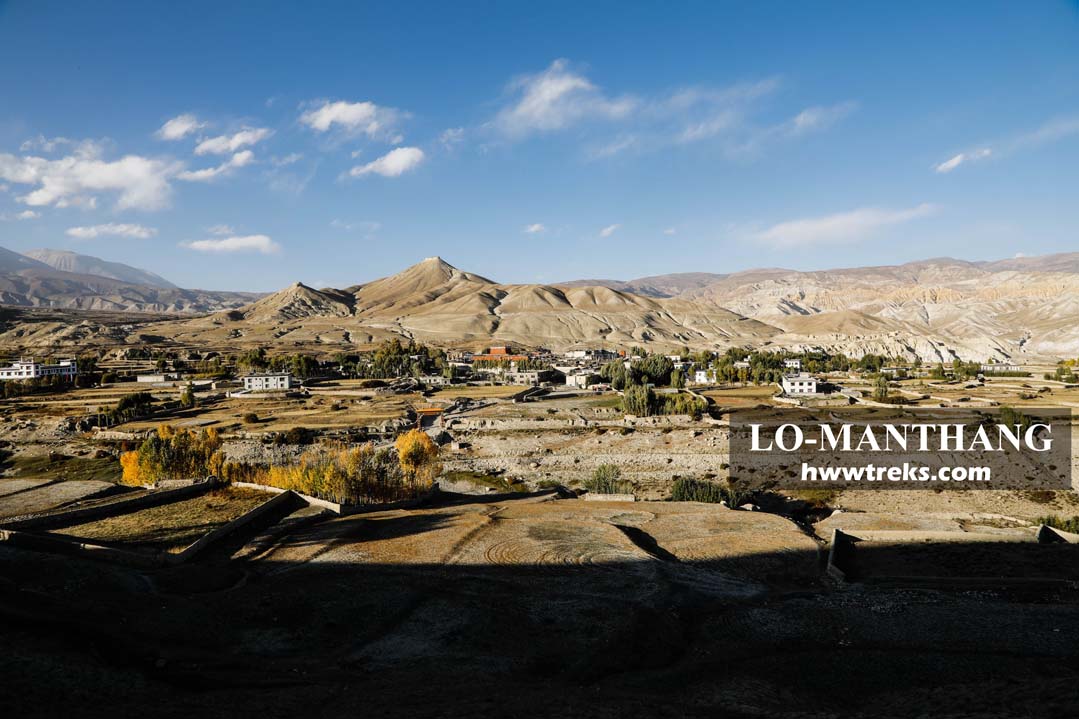
Lo Manthang is one of the must-visit landmarks of the Mustang region in Nepal. This ancient walled city was the capital of Lo Kingdom in the past, and now it is the center for the local administration of Lo Manthang Rural Municipality. This historic town of Lo is indeed a wonder to behold. There are three centuries-old monasteries within the town, which cost 1000 Nepalese rupees for an entrance ticket to all monasteries. Jampa Monastery (Jampa Lhakhang) provides an impressive view of surrounding valleys, mountains, and fascinating neighboring rooftops. Inside the wall of the monastery, there are mandala murals in three directions. The northern wall of the monastery is occupied by the 15-meter-tall statue of the future Buddha (Maitreya). Thupchen Gompa consists of both wall paintings and some of the oldest statues, such as Avalokisteswara (Chenresig), Vairocana, Guru Rinpoche, Sakyamuni Buddha, etc. The painting restoration is still going on to date (2021). Chode Monastery is home to all the monks of Lo-Manthang who perform the Tiji Festival Mask dance every year between April and May. The main prayer hall’s walls are covered with paintings of fearsome protective deities such as Mahakala, Panch Buddha, and other dharma protectors. Several statues of God and Goddesses are made from bronze, brass, copper, and even gold. Mustang Raja’s (King) palace is also another monument to visit. Each of the different sites is fascinating in its own right.
II. Charang/Tsarang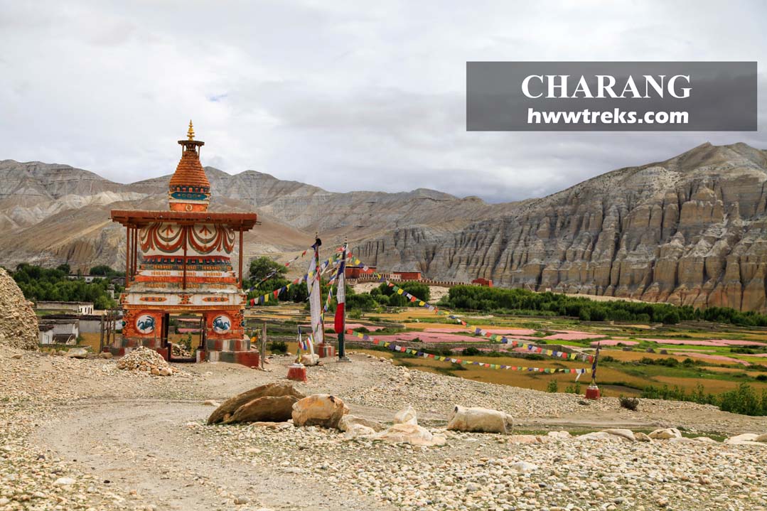
Charang (Tsarang) is the former capital of Lo, located at a height of 3575 meters. It is the second largest village in Upper Mustang, after Lo Manthang. The old palace and Tsarang Monastery perched on the edge of the eastern cliff hill, overlooking the surrounding fields and main village. The monastery is from the 14th century, and still, it stands impressively on the edge of the village and is visible from every corner of the village. Charang is a three-hour walk from Ghami and a 4-5 hour walk from Lo-Manthang. At present, it is the center for local administration of Dalome rural municipality.
III. Ghami/ Ghemi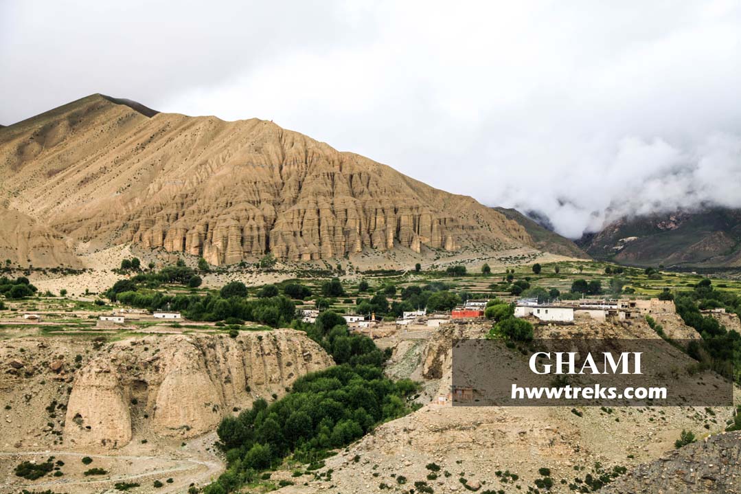
Ghami is one of the nicer villages for cultivation, which is warmer than villages around Lo-Manthang. The village is about 2 hours walk from Ghiling via Karki La (4020 meters) and 3 hours by Nyi La (4000 meters) through the Jhaite tea shop and lodge. Ghami (Ghemi) is home to a few tea houses and local homes and is surrounded by trees and fields. In the summer, buckwheat and mustard fields make this village more beautiful. Within the village, there are prayer walls, colorful Chortens, an old monastery, and alleys. The longest mane wall of Nepal lies here with the backdrop of beautiful cliffs gray, ochre, and red.
IV. Chosar
Chosar Valley is in the east of Lo-Manthang town. It is the name of the valley, and it includes many individual villages such as Arka, Bacha, Garphu, Nyiu, and Shija. Chosar was popular for side treks around Lo-Manthang, and nowadays there are a few lodges where you can stay overnight: Shelkar Guest House and Lo-Chosar Guest House. Normally, many travelers visit only a few sites, like multi-story Jhong Caves, Niphu Gompa, and Garphu Gompa, because of the limited 10-day permit. We highly recommend you visit these lesser-visited places of Rinchenling and Kunchokling. Keep two days for Chosar in your itinerary where you can visit two interesting places, Rinchenling (a really old painting of a mandala inside the cave) and Kunchokling (an outstanding landscape that you will experience nowhere in other parts of Nepal). Whether you visit all the sites of Chosar or only a few of them, the single entry ticket cost is the same (1000 Nepalese rupees).
V. Thinggar/ Thingkar village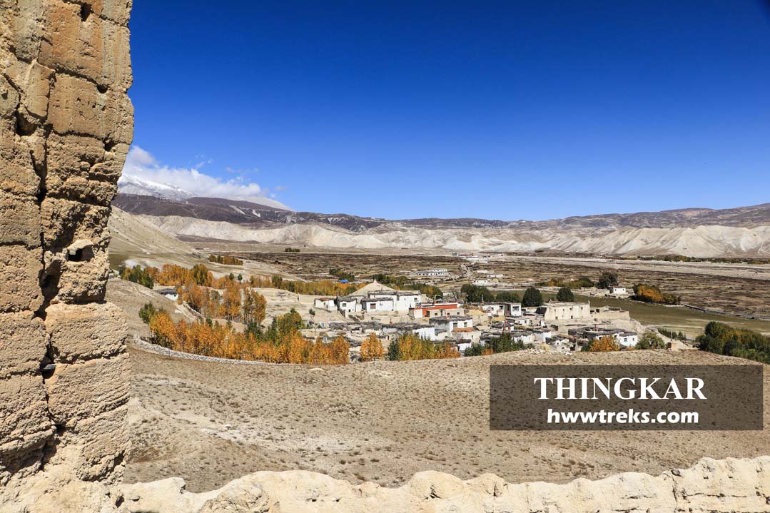
Thinggar is the most popular village in Chhonhup Valley, the western valley of Lo-Manthang. This village lies on a slope hill overlooking the neighboring villages and fields. The view of the Thingkar/Thinggar from Phuwa Gaon looks similar to the formation of the Potala in Lhasa, Tibet. The summer palace of Lo King lies in Thinggar, and it is protected well; it was destroyed in the 2015 earthquake. In 2019, the restoration work was going on. Back in the Lo King’s regime, every dispute and problem was solved at Thinggar Palace by the Lo Gyalpo. There are two ruined Bonpo monasteries in the southwest of the village. There is a village monastery that was owned by nuns decades ago under the management authorized by Namgyal Gonpa. Nowadays it solely belongs to the village, and every family is responsible for taking care of it by keeping the key, cleaning, and offering butter lamps and water in the morning. During the religious ceremony, one member of each family must participate. Some of the major religious ceremonies like Saga Dawa, summer retreat (Nyungnye), and Tsechu (Guru Rinpoche’s puja).
VI. Yara village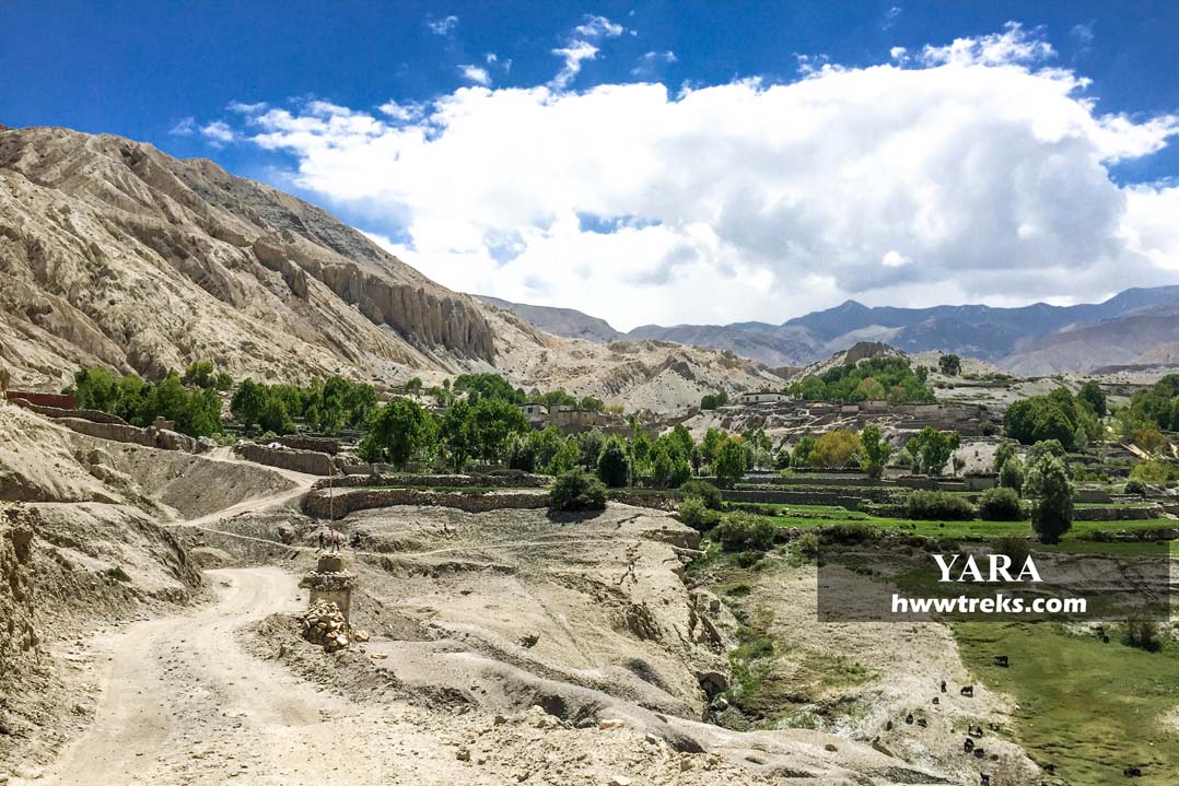
Yara is the next village from Dhi Gaun, which takes 40 minutes to walk. It is located on the hilltop on the left side of the dry river that originates from the Luri Gompa area. This village is warmer than other villages of the Upper Mustang. Geographers said that there is a lake under this village. That’s why two-story houses will not last long, and you will see all are single-story ground-floor houses. In the opposite direction of the village, there is a unique sandy cliff that amazes every traveler who visits Yara.
VII. Tangye village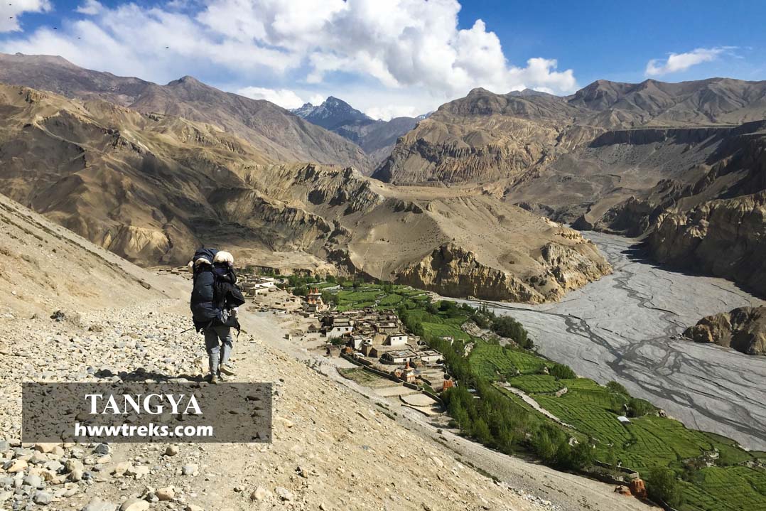
Tangye village is isolated from the rest of the villages in Upper Mustang. This village has a favorable climate for cultivation, as you will see many crops and fruits are grown there. The surrounding hills are parched landscapes except the village, which has the appearance of green fields and houses. The main occupation of people here is animal husbandry like yaks, sheep, and goats. In addition to that, they also cultivate crops like wheat, barley, potato, buckwheat, mustard, and fruits like walnuts, grapes, apples, peaches, etc. Tangye Chortens are the main highlights of the village, which remarkably beautifies the village. These iconic Chortens demonstrate the culture and traditions of the village. Each Chorten symbolized different meanings from others, such as harmony, prosperity, victory, joy, compassion, Nirvana, conqueror, etc.
VIII. Dhi/ Dhee gaon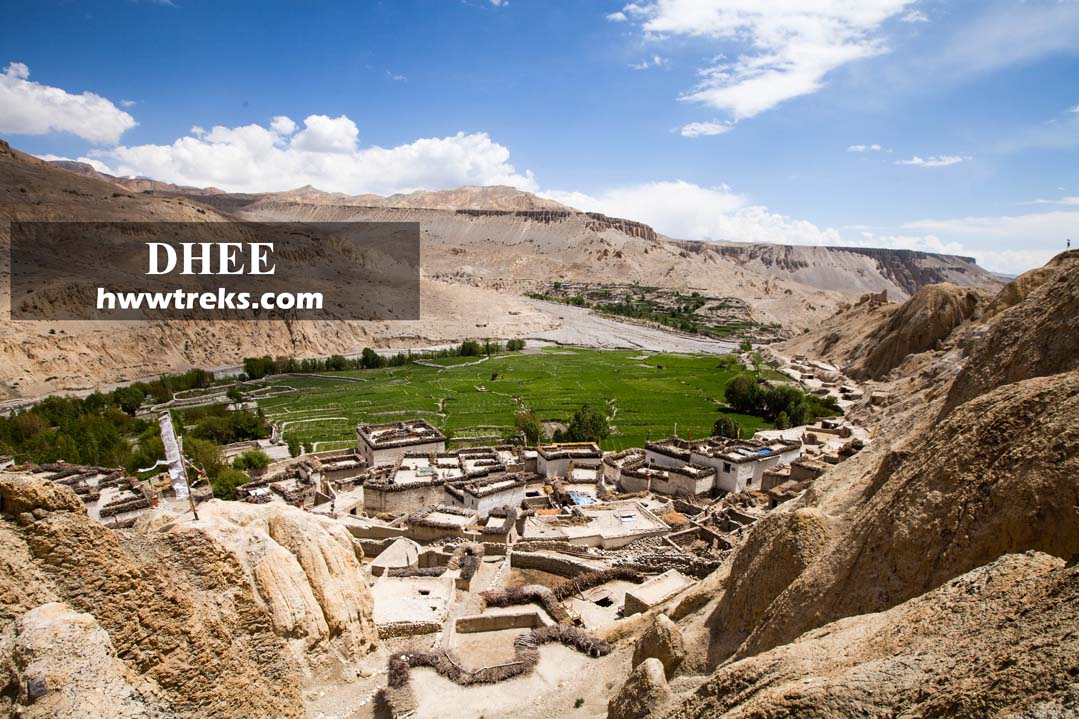
Dhee village is very small, with a mix of sandy-colored buildings compared with other villages in the eastern part of Upper Mustang. It nestled alongside the low river that originated from Lo-Manthang and mixed into the Kali Gandaki. Most of the time you will see this village green because here the land is favorable for cultivation. Many trekkers come here for lunch from Lo-Manthang and overnight in Yara.
IX. Ghiling/Geling village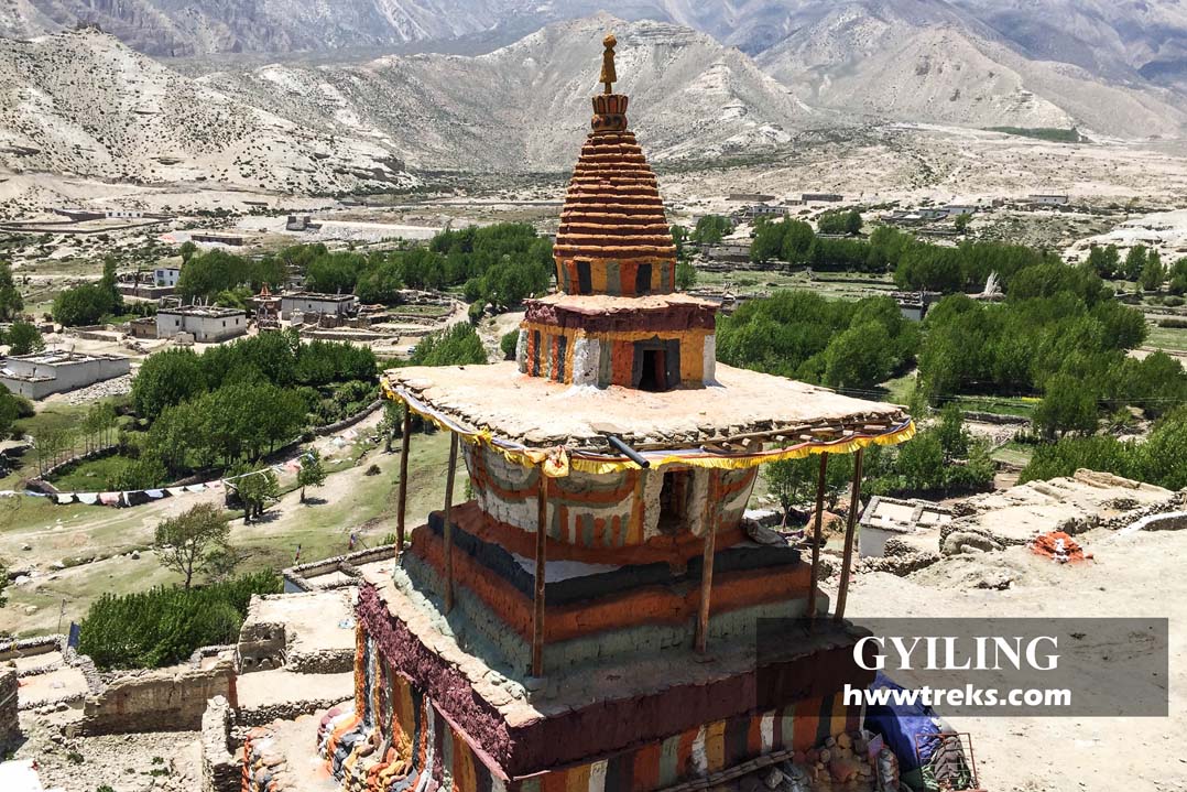
Ghiling is an hour's walk from Sangbochen. This village is a big village where there is a sacred monastery and a school, Shree Janajyoti Basic School. The town of Geling (3340 meters) in Upper Mustang sits under a rocking mountain and is split into two sides with a monastery at the center—to the right the school side while to the left a residential side. A few years ago, this village lacked a water supply.
X. Dhakmar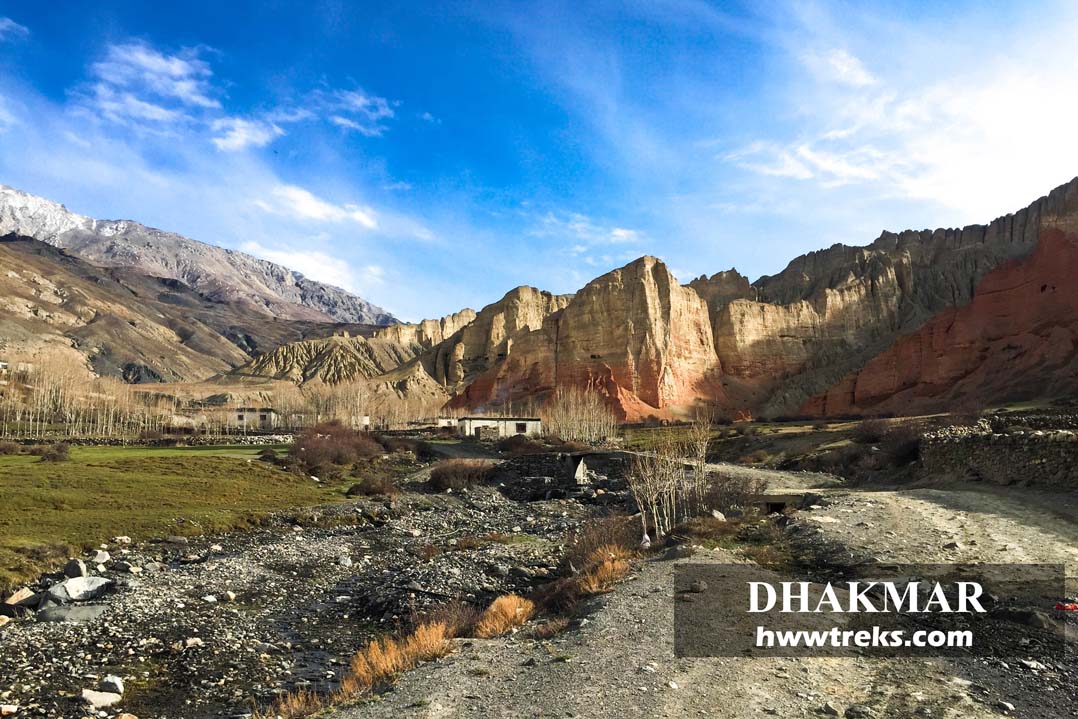
Dhakmar is visually stunning, where the village is surrounded by mountains and red cliffs in the east and west, respectively. It is stated in the story of Guru Rinpoche that the blood of demons spread over the cliff during the subdue of the demon in Lo. For trekkers, trekking through Dhakmar is highly recommended, as you will witness the oldest Buddhist monastery of Ghar Gompa. Nowadays, the trekking trail between Ghami and Charang has completely changed into a highway of Korala, and it's dusty.
2. Least popular villages of Upper Mustang
XI. Tangbe/Tangwe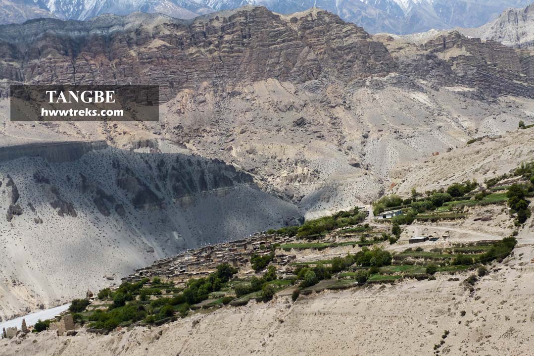
Tangbe village is locally known as Tangwe where the people are called Taipa. It is located at 11,000 feet from the sea level, an hour-long walk before Chhuksang village. The village’s thick green fields rippled with barley, and the leaves of poplar trees rustled in the wind. The narrow stone alleys, wedged between clay houses, were quiet and empty. Tapas is known for its industrious and lucrative businesses in Pokhara and India.
XII. Samdzong/ Samjong Village 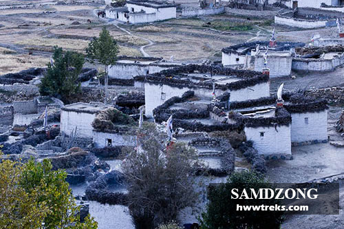
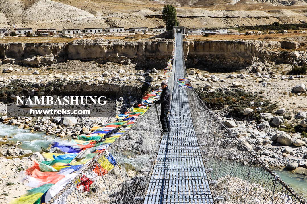
Samdzong is an isolated village in Upper Mustang that lies behind the jaw-dropping landscape of Kunchokling of Chosar Valley at a height of 4000 meters. One of the best places to hike around Lo-Manthang is Samzong if you have enough time. These days you can even take a jeep ride to Samzong/ Samjong to experience the authentic lifestyle of Lopas and the old white mud-built houses. Now only a few people are there and many moved to Namashung near Nenyol village. The Namashung was owned by Mustang royal family and Samzong residents requested that the king of Mustang relocate to Namashung. Currently, there are 18 houses which are built with the help of a Swiss Organization.
XIII. Chhusang/ Chhuksang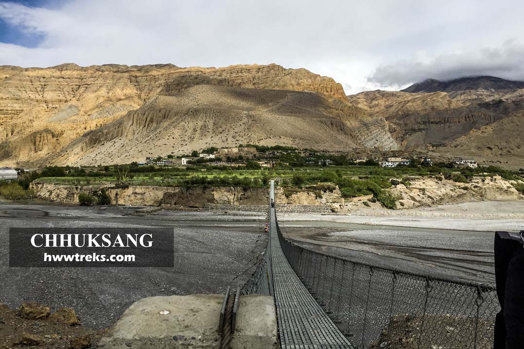
Chhusang village is the popular second-day overnight trekking camp from Jomsom. Chhuksang village is split in two by the Narsing River. Chhuksang is the correct way to pronounce it as it is spelled the same in Tibetan but many trekking maps mention Chhusang. This village is surrounded by rich fields of barley, wheat, buckwheat, peas, mustard, apple orchards, apricots and other available fruits. In the past during the summer, travelers and locals could reach the other side of the village by crossing the Narsing River where everyone used to take off their shoes. These days there is a stable aluminum bridge, which makes it easy to cross this madness river.
XIV. Chele/Tsele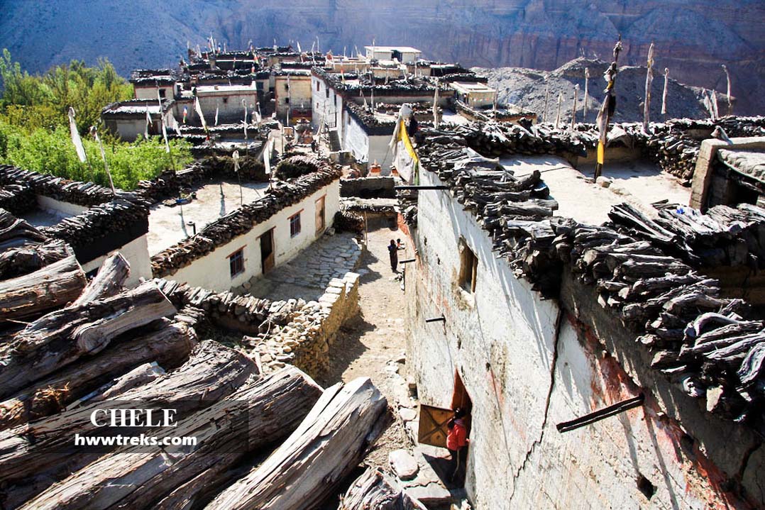
Chele village is an hour's walk from Chhusang situated at the height of 3050 meters from the sea level. It is an interesting village set on the edge of the river. There are several lodges and tea houses in Chele. Bishal Lodge is the most popular tea house for trekkers. There is always afternoon wind because of the Kali Gandaki River that lies just below the village and its surrounding deserted canyons.
XV. Bhena
Bhena is a single tea shop place that lies a few kilometers above the Chungshi Cave monastery at a height of 3860 meters. You will pass this place when you trek from Samar to Sangbochen from the upper route. It takes about one and a half hours from Samar to Bhena. The trail climbs above the Samar to a ridge, descends steeply to a stream, then climbs into a valley of juniper trees till the viewpoint, and then a gentle downhill will lead to Bhena.
XVI. Yamda
Yamda is also a single tea shop house that is built on the left side of the trail after crossing two streams from Bhena. It will take 30-40 minutes approximately by foot.
XVII. Samar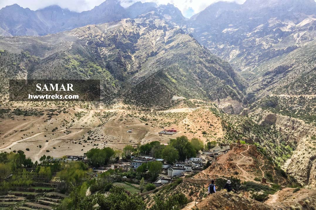
Samar is the next village after Ghyakar which is popular for lunch place. The landscape here is different from other villages. This village has 12-14 houses in total. There are two lodges, the Himali Hotel and the Annapurna Hotel. The new road skips the village and heads toward the mountain in the west. From Samar, there are two trekking routes to Sangbochen, the upper route leads to Bhena and Yamda and the lower one will take you to Chungshi Rangjung Cave.
XVIII. Ghyakar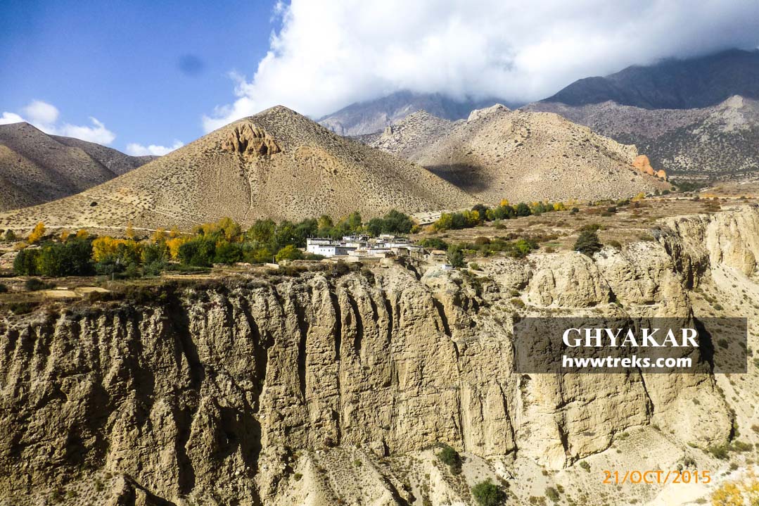
Ghyakar is an isolated village that is situated on the opposite side of the Chele and Samar cliff trail (old trekking path). Nowadays the trail has turned into a Kora la Highway that links China and India in the shortest distance. These days all trekkers trek through Ghyakar village to Samar by crossing the suspension bridge to avoid the dusty road. This village and its fields are encircled by a long wall of mud bricks.
XIX. Tetang
Tetang lies in the east of Chhuksang village. It is also known for the old Chhuksang settlement. If you reach earlier from Kagbeni then Tetang is a perfect place as a side trek from Chhuksang. The trail is flat and easy to follow. Walking through the village will offer you to experience the old ruined fortress, colorful chortens, cave cliffs on the opposite of the village and interesting underpassing allays. The landscape around Tetang is impressive and will remind you forever after completing your Upper Mustang trek.
XX. Sangbochen/ Sangmochen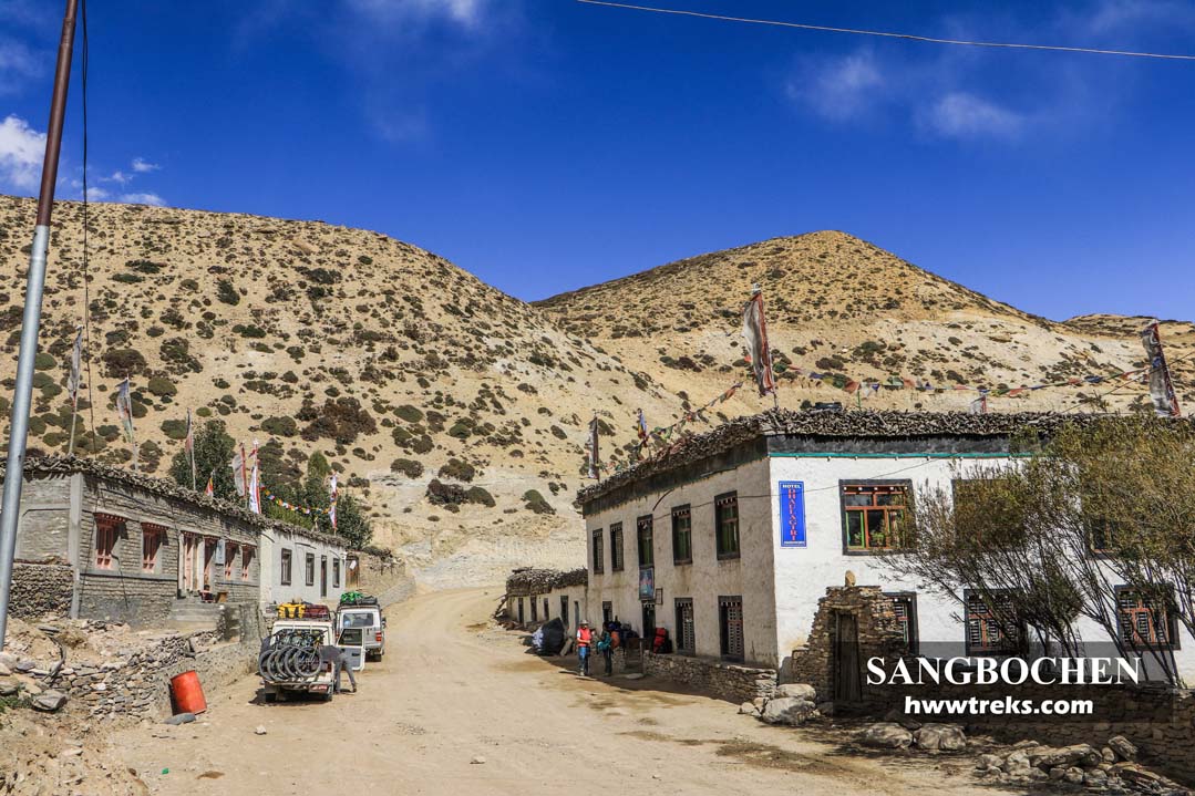
Sangbochen is a small village with 4- 5 houses which are now turned into lodges and guest houses such as Nilgiri Hotel, Dhaulagiri Hotel, Chungshi Guest House, and Anita Lodge. It is and half hour's walk from Bhena and one hour from Chungshi Rangjung Cave Monastery. The name of this village relates to the story of Guru Rinpoche, a Buddhist Tantric Master who had chased Demon in Mustang from Jomsom to Dhakmar. In this story, Guru Rinpoche meets a little girl in this village and asks her name and questions her “Did you see the demon running through your village?” She answered him that her name was Sangmo and she saw the lady with long hair and scary looks running toward Tamagaon. So, the name of the village became Sangmochen where ‘Sangmo’ is the name of that little girl and ‘Chen’ is the suffix word that is used to represent a place in the Tibetan Language.
XXI. Tama gaon
Tama Gaon is a village that lies at a height of 3710 meters. There are only four houses. If you trek from Sangmochen to Ghami through the old salt route you will pass Tama Gaon on the way. From Sangmochen it takes about 40 minutes to walk.
XXII. Chhunggar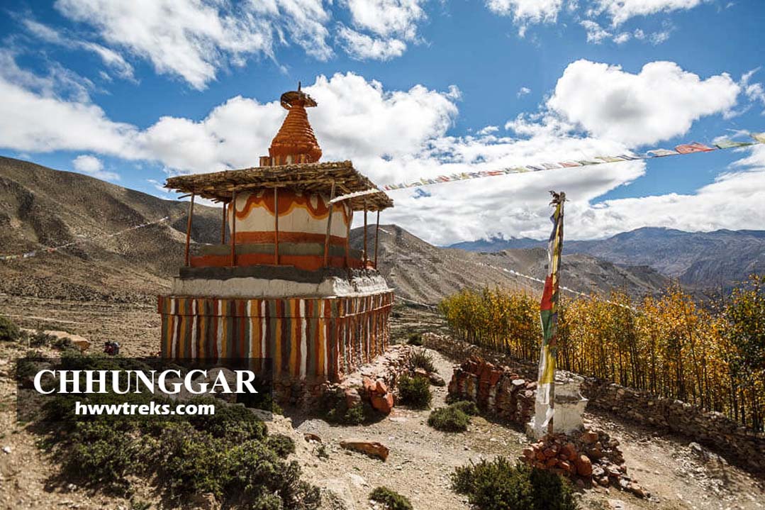
Chhunggar lies above the left of the trail a few minutes before the Jhaite. This place is isolated from the Ghiling village and there are only two houses. Nowadays the trail has changed into Kora La highway.
XXIII. Jhaite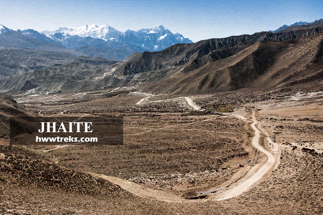
Jhaite is a place that lies just on the foot of the Nyi La (4020 meters). This place is popular for tea break stops. Many trekkers prefer to stop for a tea break at Jhaite before ascending to Nyi La. This place belongs to Ghiling Village.
XXIV. Marang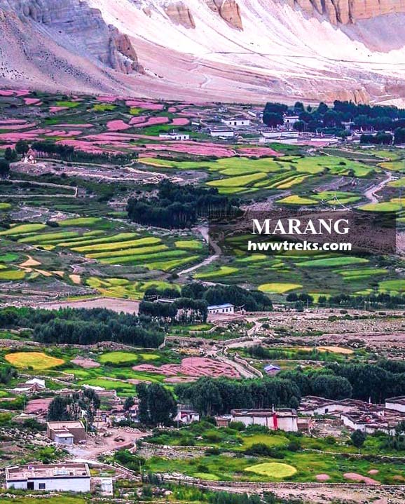
Marang is quite a big village that lies a few kilometers below the Lo Gyakar Gonpa (Ghar Gompa). Ngari Panchen Rinpoche was born in Ghar Gompa and the locals from Marang look after the monastery. There are 48 householders within the Marang village, a small village of Sakre is counted as a Marang village. The soil here is one of the best in upper Mustang for cultivation.
XXV. Namgyal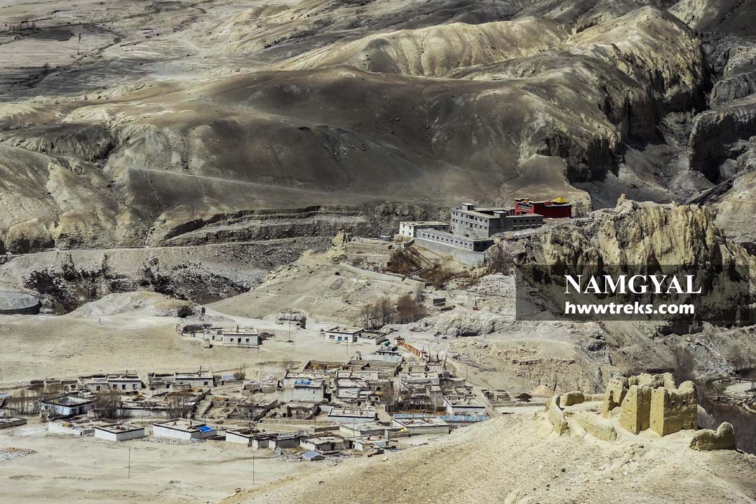
Namgyal is a village northwest of Lo Manthang, surrounded by many ruined forts. It is included under the Chhonhup village development committee. This village is well known for its majestic monastery, Namgyal Gompa which is located on the edge of the cliff.
XXVI. Phuwa
A small village lies in the opposite direction of Thingkar village. It is about 20 minutes from Thingkar and 25 minutes from Namgyal village. The houses are congested and walking paths are narrow. Behind the village, there is a cave monastery that nestled on the cliff of Teri Khecho Ri.
XXVII. Nyamdo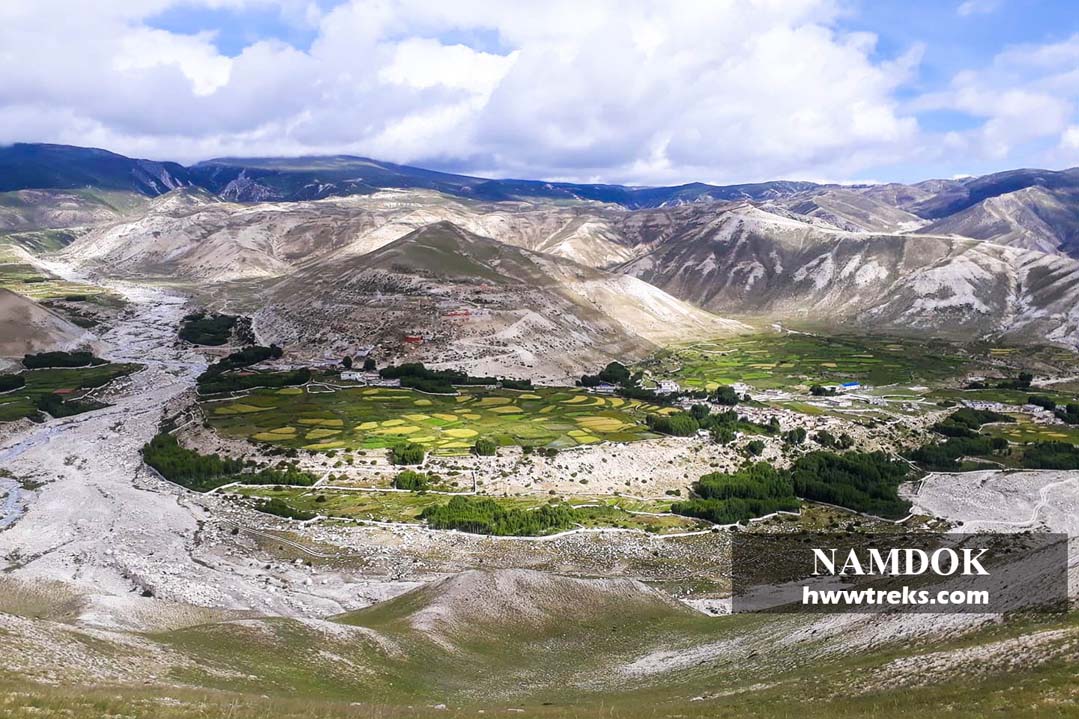
Nyamdo or Nyamdok village is the last village that lies close to Nepal China Border, Korala. Above the Nyamdok village, there are several Chortens that have been renovated recently this year (2021). It is said that Buddhist scholar Dawa Gyaltsen visited this place and left his footprint which can be seen on the big rock, way to Praying Flag Hill. The Korala Highway just passes next to Nyamdo village where Nepal Custom Office is located. Many locals are expecting that there will be more potential for import and export port business in the future.
XXVIII. Chungchung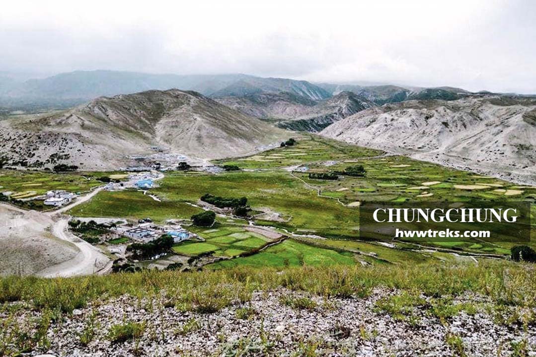
Chungchung village lies on the west of Nyamdo. Chungchung is known for Yak herders. Almost every family owns yaks. These days they are semi-farmers as they own yaks and also cultivate crops during the summer season. Most of the family live within the village. Only some members stay with yaks to take care of them. Bhalyo and Shya are the main settlements of nomadic life. In the winter they move to Ghami Mountain or even farther in the west to Dolpo if there is no more snow. In the summer this village is one of the best places for outdoor picnics where the relaxing meadow just appears on the east of the village community hall.
XXIX. Kimaling Village
Kimaling is a neighboring village of Thingar And Phuwa. It is a 30-minute walk from Thingar village. This village is larger than Phuwa and Namgyal. The ward office of Chungchung, Nyamdo, and Kimaling lies here. There used to be one elementary school in each village of Chhonhup Valley but now all are combined as one and it is called Shree Chhonhup Jhinju Basic School. This school started the operation of a hostel this year, in 2021. This elementary school goes into hibernation every November, taking all the students and teachers down to Pokhara to escape from the harsh winter. If you are traveling to Upper Mustang and looking for where to donate and help. We suggest you help government schools like this.
XXX. Nenyul / Nenyol Village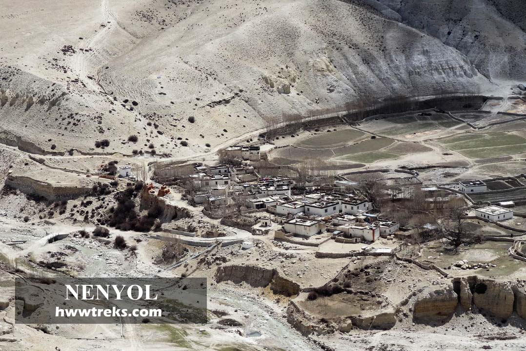
Nenyul village lies at a height of 3880 meters from the sea level. It is about 45 minutes from Lo-Manthang. When you hike to Kunchokling or Samjong you you will pass this village. If you drive to Choser you will see suspension bridge on your right side. Just above the bridge, the village is hidden behind the chortens, monastery, and trees. The village name is pronounced as ‘NeYul’ where Ne means Barley and Yul means Village.
XXXI. Chhorak village
Chhorak village is located at the Chhorak Dokpo on the northern side of the walled city, Lo-Manthang. Locals of this village are popular for folk dances and songs. In the past locals from these villages were invited for special occasions to perform Tibetan opera which is also known as Ache Lhamo. This tradition of performing Tibetan Opera was started by Thang Tong Gyalpo in 1a 4th-century mystic. Houses are few as compared with other villages. When you do a trek or take a jeep trip to Choser, you will pass this village by crossing Chhorak Dokpo (here Dokpo means river in the local language).
XXXII. Ghara 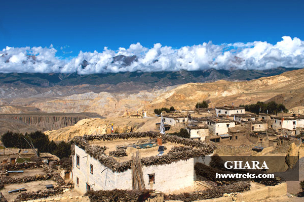
Ghara village lies at the height of 3770 meters from the sea level, about an hour's walk from Yara. Ghara village is popular because of the mighty holistic Luri Gompa that lies on the cliff 25 minutes away from Ghara by foot. Locals here are mostly Nyingmapa sect of Tibetan Buddhism where each man from many families are Ngakpa (Semi monk who practices Nyingma and looks after his family). From Ghara when you climb a hill on the west of the village you will witness the views of the west valley, Chhonhup. The most common wild animals that you can see here are blue sheep that visit the village for water in the late afternoon.
XXXIII. Dhe Village 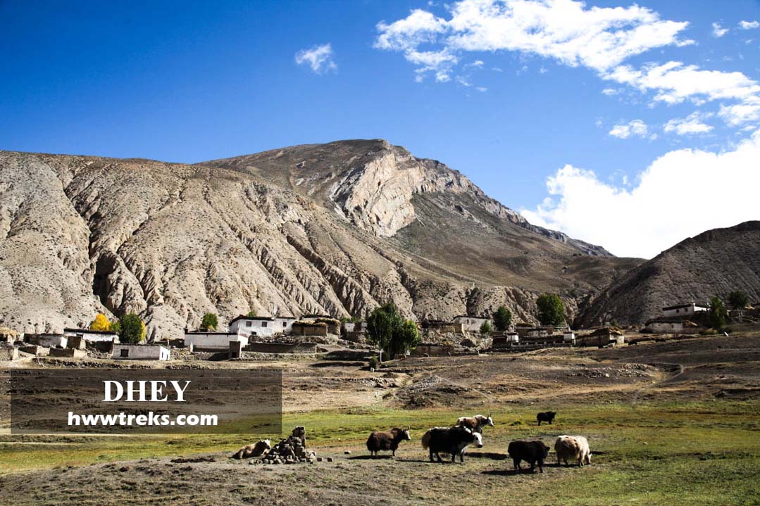
Dhe is a small village located in the eastern part of Upper Mustang isolated behind the Dhe la Pass. People residing in Dhe are known as Dewa which means a blissful land of Buddha or Sukhavanti in Sanskrit. They speak Tibetan dialect, known as Lowa which is quite different from Standard Lhasa Tibetan. There are about 14 households. Due to climate change, this village faced drinking and irrigation water shortages and now most of them have moved to Dhetsang where the new settlement is established there. Dhetsang lies on the back of the Dhe and Kaligandaki Rivers in the opposite direction of Charang village. There are apple farms that were imported from France. If you are trekking from Yara to Tange then this place will be your lunch point.
Read Similar useful blogs regarding travel to Upper Mustang from the below lists;
- Best Treks in Upper Mustang
- Why you should visit Upper Mustang
- When is the Next Tiji Festival of Lo Manthang?
- What is the Tiji Festival?
- Must see places in Upper Mustang
- Three Major Monasteries of Lo Manthang.
- Upper Mustang Trekking Guide
- Bagcham of Namgyal Monastery
- Local Trekking and Tour operators For Upper Mustang
- Shaligram Shila (ammonite) of Mustang
- Hotels in Mustang