- 21/09/2025
- Tags: Trekking in Nepal
- Himalayan Wander Walkers
My Inner Dolpo Trek Experience in Nepal's Remote Tibetan Region
Written By: John Parker(Trip date: 11th May-2nd June 2025)
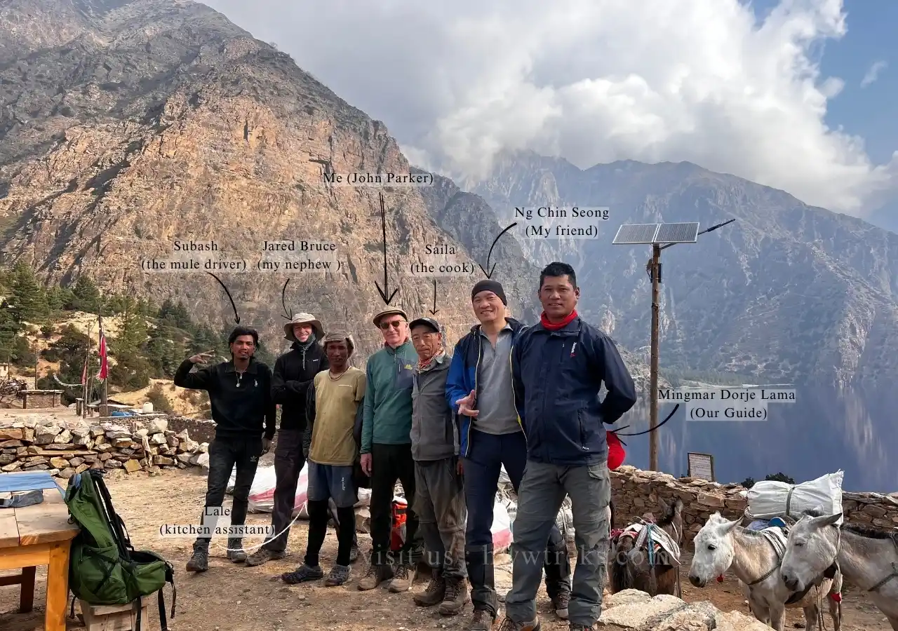
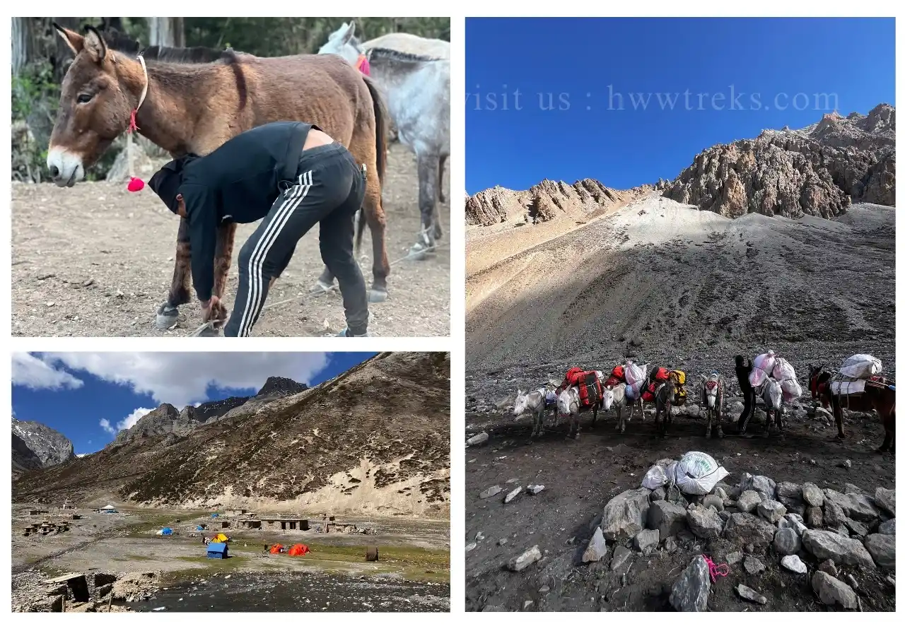
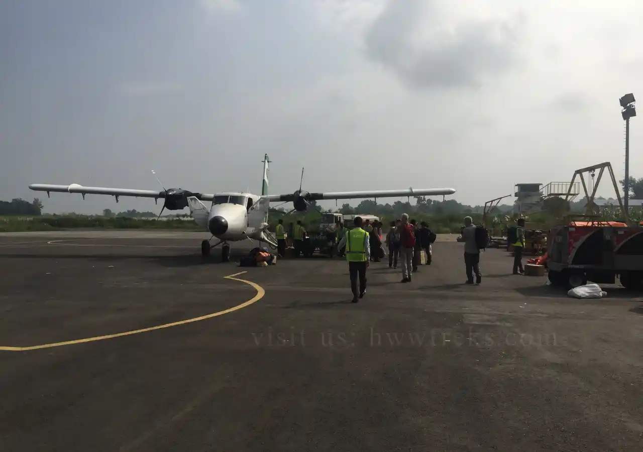
In May 2025, I went on a trek to Dolpo, organized by Dawa Tseten at Himalayan Wander Walkers. Like Upper Mustang, the northern parts of Dolpo (usually referred to as Inner Dolpo) lie in a restricted frontier area where trekking is allowed only in an organized group with a guide. The absence of permanent teahouses in much of the region means that most people undertake the trip as a camping trek. I therefore formed a small group with my nephew Jared Bruce and friend Ng Chin Seong, whom I had met three years before in Mustang, and we were accompanied by a five-man Nepali team as well as by seven mules to carry our equipment and food. We approached Dolpo by the usual route, flying with our guide Mingmar Dorje Lama from Kathmandu to Nepalgunj on the border with India and the next day flying from there to the airfield at Juphal. From there, it was just a few hours' walk to our first camp at Sulighat on the banks of the Thuli Bheri River, where we rendezvoused with the rest of the team: Saila, the cook; Lale, his kitchen assistant; Mingmar Nuru, the sherpa; and Subash, in charge of the mules. The next morning we set out on the eighteen-day trek: our route would take us up the Suli Gad valley to Phoksundo lake; around the lake and over the Nagdalo La (i.e., the Nagdalo pass, 5,350 m.) to Shey Gompa; over the Sela La (5,095 m.) and down into the central Nangkhong valley of Inner Dolpo; then over a third high pass, the Jyanta La (5,220 m.) to Dho Tarap and from there down to the Tichurong region and back along the Thuli Bheri to the regional headquarters at Dunai. What follows is an account of the trip, together with some observations that readers contemplating undertaking it or a similar trek to Dolpo might find useful.
Contents [hide]
- Western Nepal Trekking: From Apple Pie Trail to Upper Mustang
- Discovering Dolpo: Tibet's Hidden Buddhist Kingdom
- Planning the Perfect Dolpo Trek
- Suli Gad Valley: Cordyceps Harvest Season and Local Culture
- Crossing Nagdalo La Pass (5,350 meters)
- Crystal Monastery and the Mystery of Missing Mules
- Tarap Valley and its Landscape
- Final Days Through Dolpo's Stunning Pine Forests
- Dolpo's Harsh Beauty: Not Your Average Nepal Trek
- Is Inner Dolpo Trek Worth It?
Western Nepal Trekking: From Apple Pie Trail to Upper Mustang
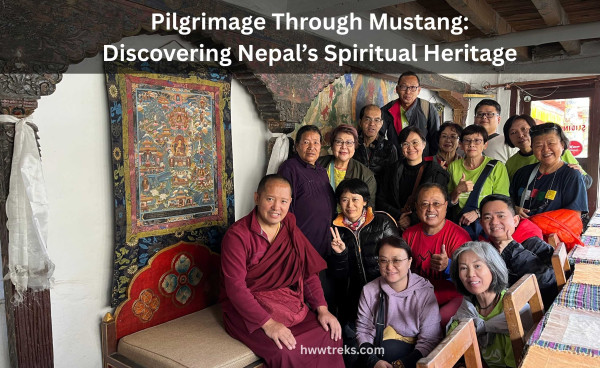
This was not the first time I had been trekking in western Nepal. My first trek was way back in January 1982, when I walked from Pokhara to Muktinath and back: a route known at the time as the ‘Apple Pie Trail’ along the Kali Gandaki River to the Thakali region, famed for its comfortable teahouses with excellent kitchens. Two decades later, in 2001, I returned and did the same walk. This was still well before the road was constructed along the Kali Gandaki, but the number of trekkers and teahouses had increased dramatically, and there were now regular flights from Jomsom back to Pokhara. Twice I had reached Kagbeni, the atmospheric old town which guards the frontier between Lower Mustang and Upper Mustang, and twice I had been unable to go further: the latter had been opened to trekkers in the 1990s but only in camping groups, and in 2001 we were just two people walking independently. It took me another twenty years to finally make it beyond Kagbeni, when in 2022 I organized a trek to Upper Mustang with Dawa at HWW. By then, things had really started to change: a road now went all the way to Jomsom and from there to Lo Manthang and on to the border of China/Tibet. Rather than walking from Pokhara as in the past, my guide Chhimek and I caught the daily local bus to Jomsom and set out from there on foot to Kagbeni and beyond to Lo Manthang, a route which is now too well equipped with teahouses. For the people of Mustang, the road has brought change, not all of it welcome: the large caravans of ponies and mules which historically carried goods up and down the Kali Gandaki valley and were a mainstay of the local economy are now a thing of the past, replaced for the most part by lorries. Roads are also starting to extend into neighbouring Dolpo, and it can only be a matter of time before they bring similar change to what has long been one of the most remote parts of the Nepal Himalaya.
Discovering Dolpo: Tibet's Hidden Buddhist Kingdom
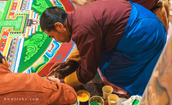
It was during my preparations for the trek to Upper Mustang that I began to read up on Dolpo to the west. Both regions form part of the trans-Himalayan ecological zone; they lie, that is, to the north of the main Himalayan range and are in its rain-shadow – effectively an extension of the Tibetan Plateau into Nepal. Due to low rainfall and high altitude, their trekking season is in the summer from May to October; on either side of those months, the high passes are often blocked by heavy snow, and many local people depart to escape the severe cold. Culturally, Dolpo is also a Tibetan-speaking Buddhist region, although Bon – often said to be the ‘pre-Buddhist’ faith of Tibet, but which some scholars think is more likely to have taken shape in dialogue with Buddhism – has a significant presence. Dolpo has interesting Bon gompas (or monasteries) which can be visited – the lama of one of the most important, Shyamling, was a fellow passenger on our flight to Juphal, and we would meet him again at Phoksundo as he made his way home. One reason for the persistence of Bon is that Inner Dolpo’s remoteness served to cut it off to some extent from the main currents of Tibetan Buddhism. The region lies within a horseshoe-shaped ring of high mountains, open to the Tibetan Plateau to the northwest and divided by interior ranges into three narrow valleys. Most of the settlements in these valleys lie at over 4,000 meters, making Dolpo one of the highest permanently inhabited regions in the world. This remoteness meant that few outsiders visited Dolpo before it was opened to foreign trekkers in the 1990s. One who did was the British Tibetologist David Snellgrove, who in 1956 entered Dolpo by the same route as us (although it had taken him and his Nepali companions a month to walk from Nepalgunj to Dunai rather than forty minutes in the plane!) and left a valuable account of the region and its Buddhist culture in Himalayan Pilgrimage, first published in 1961. Snellgrove returned to Dolpo in 1960-61, staying over the freezing winter to transcribe the biographies of four Buddhist lamas who had lived between the fifteenth and eighteenth centuries, which he published in translation in a second book, Four Lamas of Dolpo (1967). Better known, however, is The Snow Leopard by Peter Matthiessen, an evocative account of a 1973 journey to Shey Gompa and nearby Crystal Mountain. These books are usually available in the better bookshops of Kathmandu and are well worth reading in preparation for a trip to Dolpo. Another interesting account is Kenneth Bauer’s High Frontiers (2004), a study undertaken in the late 1990s of the changes to the pastoral economy following the closure of the Chinese/Tibetan border to Dolpo’s yak herders in 1959. I was intrigued to see what remained of Dolpo’s ancient Buddhist and Bon culture, but also to get a sense of how the region had continued to change over the past quarter of a century.
Planning the Perfect Dolpo Trek
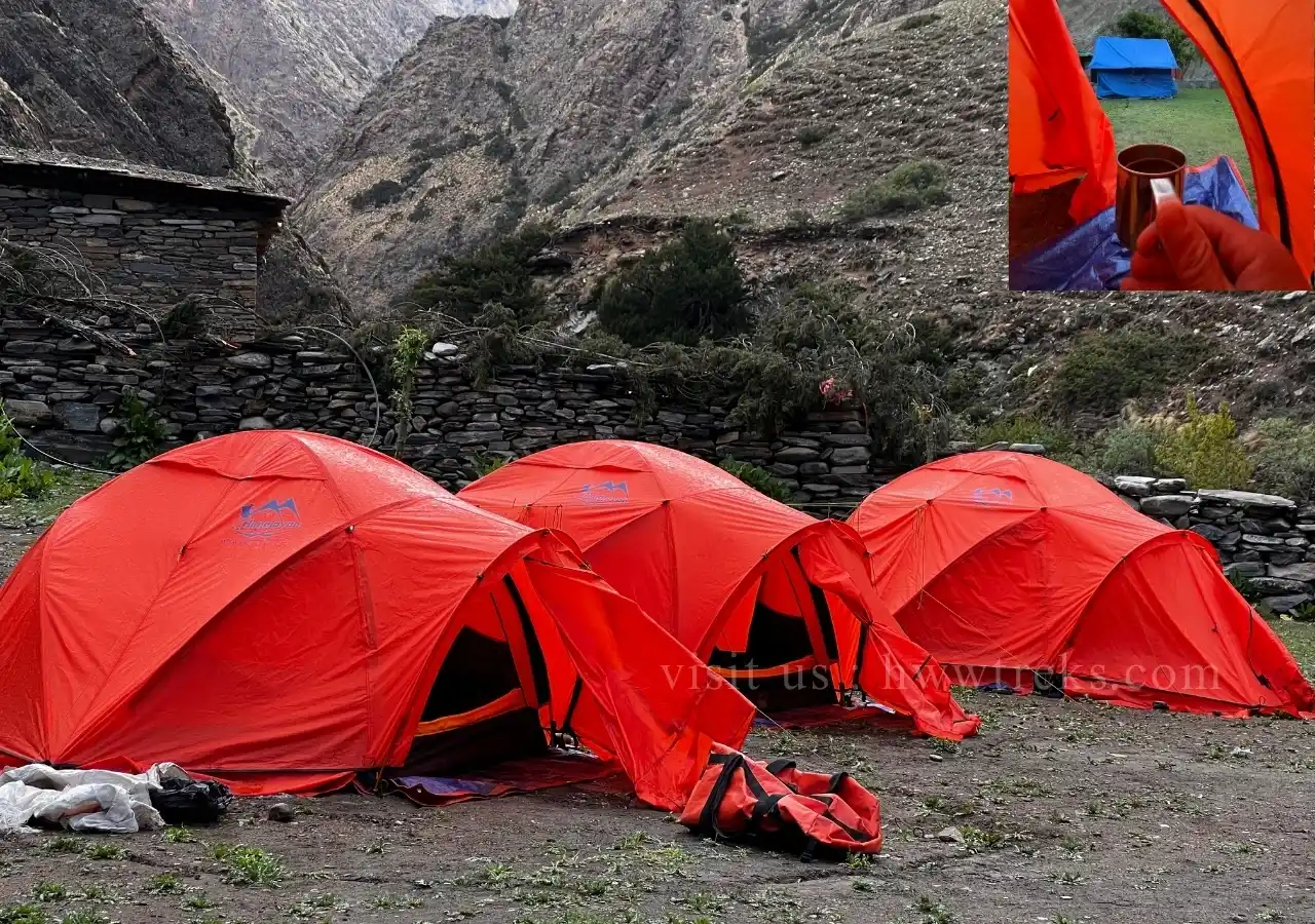
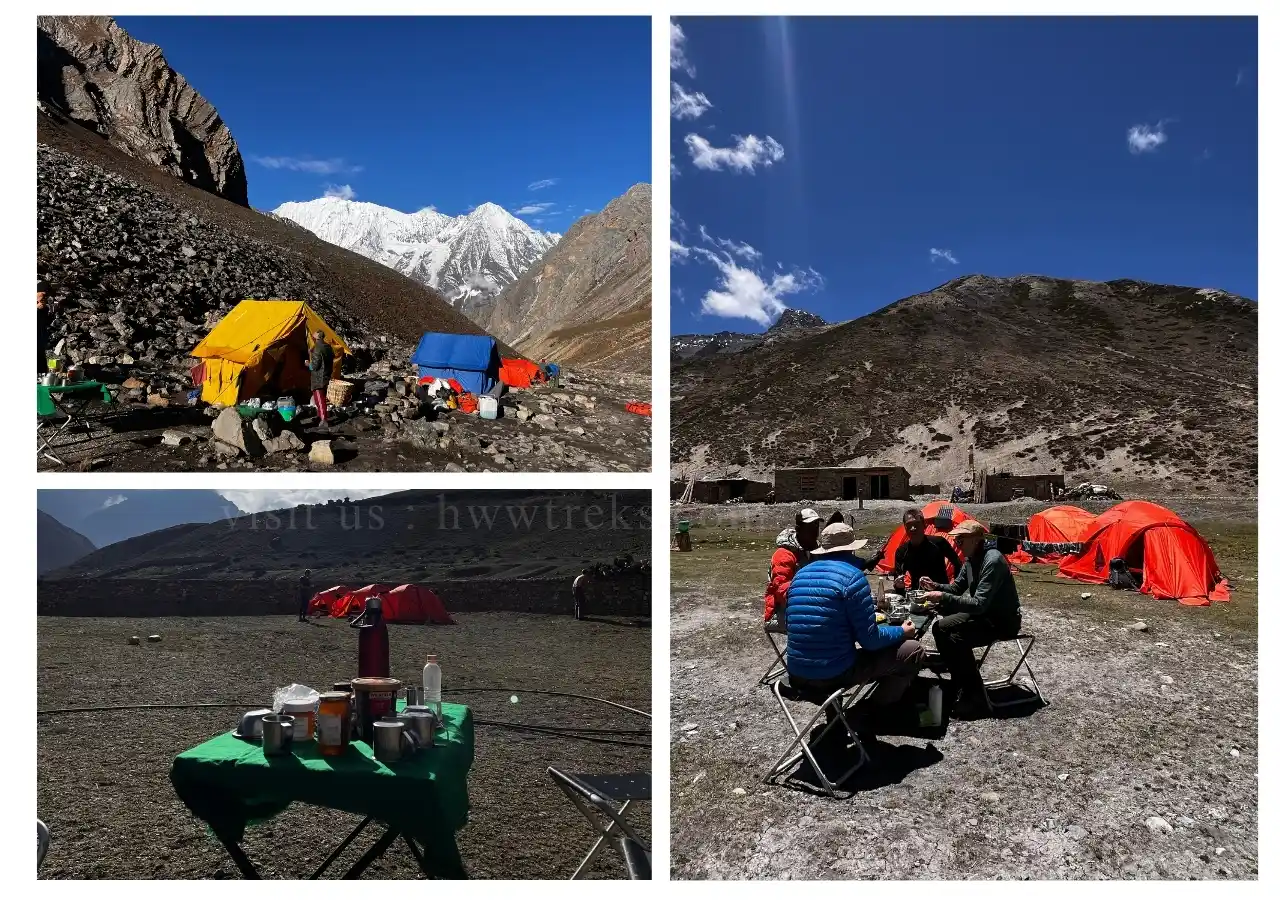
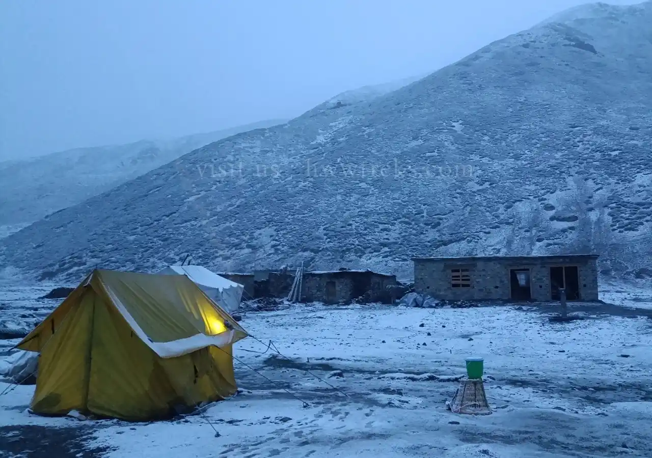
Dawa and I had planned the trekking schedule to take account of the need to acclimatize to Dolpo’s high altitudes and to have time to explore places of interest along the route. Over the course of the eighteen-day trek, we aimed to walk for three days, have a rest day on the following day, walk for another three days, and so on. Except for a slight hiccup to our plan at Shey Gompa, that’s how it worked out. The walking was certainly arduous at times, but none of us experienced any symptoms of altitude sickness (although mild headaches, nausea, and insomnia are not uncommon before your body adjusts). On a typical day, we’d walk for three hours in the morning, stop for a cooked lunch, walk for another three hours or so, and then set up camp by mid-afternoon. To say that the meals were hearty is an understatement. Aged over seventy and by all accounts something of a legend in the trekking world, Saila presided over a mobile kitchen that turned out a wide range of delicious food, from dal bhat and momos to puddings and pizza. Part of the challenge of getting going each morning was walking off his three-course breakfast. On those sections of the trek where basic teashops (including seasonal ‘tent teashops’) now exist, we’d usually camp adjacent to them and use their kitchen facilities to cook and sometimes to eat in. Elsewhere – such as in the high camps below the passes – we’d set up our own kitchen tent, dining tent and, when needed, toilet tent. Jared, Ng, and I each had our own roomy sleeping tent – very cozy to crawl into at the end of a day, especially at 4,500 meters.
Suli Gad Valley: Cordyceps Harvest Season and Local Culture
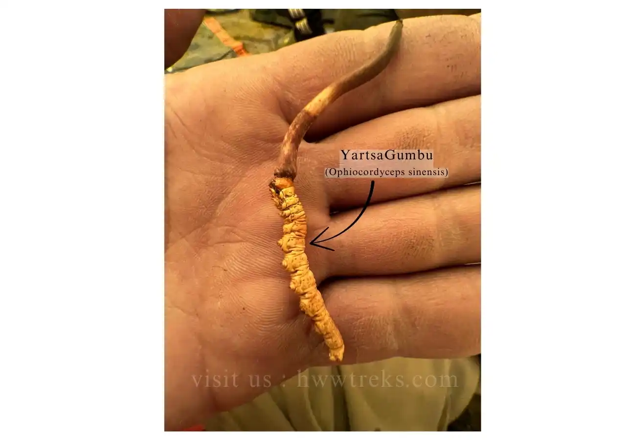
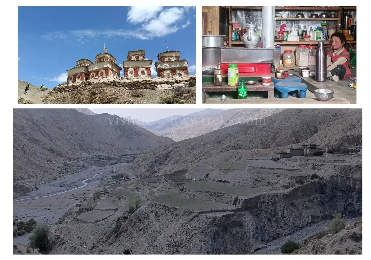
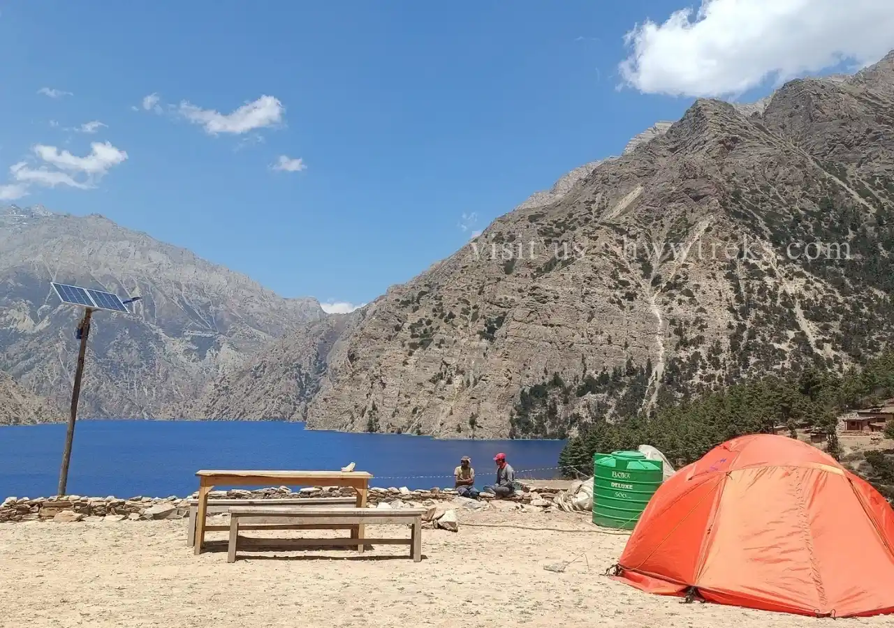
The first three days of the walk took us steadily up the narrow and often beautifully forested valley of the Suli Gad, which flows south from Phoksundo Lake and above Chhepka is marked on the map as the Phoksundo Khola. The trail was relatively busy on this stretch: quite a few trekkers walked up to the lake and back, which can be done independently and without needing the permit necessary for Inner Dolpo beyond. Most foot traffic, however, was caravans of local people moving north to gather the Cordyceps medicinal worm, known in Tibetan as yartsu gunbu. This was an early indication of the impact of the demand for Cordyceps on local society: during the springtime harvest season, thousands of people are drawn to Dolpo, and within the region, entire communities decamp to the high mountainsides in search of the valuable worm. On the third morning, the path cuts across a precipitous cliff face before winding up towards the settlement of Ringmo on the southern shore of Phoksundo Lake. We were now at around 3,600 meters, and the presence of a large chorten on the path before Ringmo announced that we had arrived in the world of Tibetan Buddhism. Although we would continue to encounter caravans of local Cordyceps gatherers, after leaving Phoksundo, we did not see another trekking group for the remainder of the walk.
Crossing Nagdalo La Pass (5,350 meters)
Having visited the Bon gompa at Ringmo on our rest day, we set off on a spectacular track around the western shore of the lake and then, after lunch, up a wide riverbed to its north. That night was our first out in the wild: we set up camp on the banks of the northern branch of the Phoksundo Khola in a grove of young pines with the snow-covered flank of Kanjiroba (at 6,612 m. the highest mountain in the region) towering over us. Saila and Lale supplemented our vegetable stocks by gathering armfuls of wild garlic from the hillsides. The next morning, we turned to the northeast, the path entering a narrow defile between two walls of rock before climbing to the high camp below Nagdalo La. At around 4,700 meters, we were now well above the tree line, and snow lay on the surrounding mountainsides. We woke up to a cloudless sky the following morning and, with Kanjiroba towering at the bottom of the valley behind us, set off for the pass. Once you’re over 5,000 meters, it’s very much one step at a time, and, at age sixty-four, I was happy that it was the mules carrying my stuff up the steep trail and not me. There was a bit of residual ice and snow at the top of the pass to negotiate, then it was a stunning walk down the other side towards Shey Gompa, with row upon row of barren ranges lined up on the horizon towards the Tibetan frontier. We had crossed the western ‘horseshoe’ of mountains and were now inside Inner Dolpo.
Crystal Monastery and the Mystery of Missing Mules
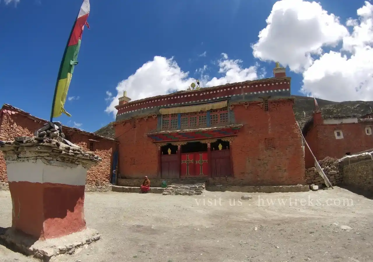
Taking its name from the nearby sacred mountain, Shey Gompa or the ‘Crystal Monastery’ is an atmospheric place, perched above the junction of two rivers with mountains rising on all sides. We spent a pleasant day there, being shown around the gompa by the resident lama and wandering to a smaller hermitage further up one of the surrounding valleys. That afternoon, however, things went awry: having gone to round up the mule team, which, when there was enough vegetation on the hillsides, were let off their leads to graze, Subash came back empty-handed. The mules had wandered off and were nowhere to be seen. Rather than set off the next morning as planned to cross the Sela La and then drop down to Namgung – at 4,360 meters the highest settlement on our route – we were forced to stay another day at Shey to locate the errant mules. Despite search parties being sent up the various valleys, they remained lost. Perhaps, we speculated, they had followed one of the many caravans of Cordyceps gatherers that had been passing through Shey. It was lucky that we were at an important local crossroads, however, because Mingmar was able to arrange for an alternative mule team to be assembled. That evening, the weather closed in, and it started to snow. The next morning, we were able to set off with our replacement team and a new ‘mule man’, nicknamed KB, leaving Subash behind to consult on the mystery with the lama. Crystal Mountain, the lama suggested, may have ‘eaten’ the mules – although some days later we were relieved to hear that they had been found safe and sound many kilometers up one of the valleys. Rather than overnight at Namgung, we carried on in one day to Saldang, the largest settlement in the Nangkhong valley. We were thus back on schedule. Tired after crossing the pass and combining two days' walk into one, however, we decided to spend the next day loafing about at Saldang rather than taking a long day trip up the valley to Yanjer Gompa. This was somewhat disappointing, as the ancient gompa was to have been the culminating point of the trek, but we were well rested and the next day ready to start heading south towards Dho Tarap.
Tarap Valley and its Landscape
Our route back first took us up the Nangkhong valley to a high camp below the Jyanta La, then over the pass the next morning, followed by a long walk down to Thaksi, the first of a scattered group of communities collectively known as Tarap. Compared to the small, quiet villages to the north, the Tarap valley felt like a hive of urban activity, with locals buzzing around on motorbikes, tractors, new houses being built, and large herds of dzo (yak-cow hybrids) grazing on the surrounding hills. A road heading east to Chharka and on to Mustang was now open, and new goods and technologies were coming down it. From Thaksi, it was a short walk to the main settlement of Dho Tarap, so we had most of that day and the following to explore. The valley has some interesting gompas, including Ribo Bhumpa on a hillside above Dho Tarap. This has an unusual chorten with another chorten built inside it, said to contain the remains of a demon killed by Guru Rinpoche (or Padmasambhava, ‘Lotus Born’), the great eighth-century figure credited with the spread of Buddhism throughout much of Tibet. The demon’s heart, we were told by the lama’s daughter, who kindly showed us around, was interred separately within a great rock along the route to the south, which we saw the following day. We also walked over to a nearby Bon gompa, Shipchok, but it was locked and the settlement surrounding it deserted: everyone, we were later told, had gone worming.
Final Days Through Dolpo's Stunning Pine Forests
The next morning, we set off on the final stage of the trek: a three-day walk down the Tarap Khola back to the Thuli Bheri, then on to Dunai. We soon dropped back below the tree line into a narrow valley covered with towering pines and spruces; the following two days took us through some of the most stunning landscapes of the entire trek. By the time we trudged into Tarakot, we were back down to around 2,500 meters; 2,000 meters higher in Inner Dolpo, the shoots of the barley crop were just starting to appear in the brown terraced fields, but here it was already ripening and golden. The next day, we were in Dunai in time for lunch, staying for the first time in eighteen days in a teahouse so the guys could clean and offload all the camping equipment. The trek was over. As there were no flights from Dunai for three days, all that remained was a day-long jeep ride back to Nepalgunj to connect with our flight back to Kathmandu.
Dolpo's Harsh Beauty: Not Your Average Nepal Trek
Trekking in Dolpo would not be for everybody. It is remote, high, thinly populated, and lacks the creature comforts now taken for granted in the teahouses of the Annapurna, Manaslu, and Everest regions. Nor does it have the spectacular views of snow-capped mountains which draw trekkers to these regions: Mingmar Nuru, our sherpa, who was making his first trip to Dolpo, was taken aback at the harshness of the desert-like landscape compared to his own Solu Khumbu region. The permit for Inner Dolpo, like that for Upper Mustang, is also expensive. These factors conspire to keep the number of visitors venturing beyond Phoksundo Lake very low: we went in late spring – along with early autumn, one of the two ‘peak’ seasons – and, as mentioned above, did not see another trekking party for the rest of the walk. For those who have encountered the crowded bottlenecks on trails elsewhere in Nepal, of course, therein may lie one of its main attractions.
Is Inner Dolpo Trek Worth It?
What Dolpo also offers is the opportunity to experience a remaining outpost of Tibetan Buddhist – and Bon – culture in a starkly beautiful high desert environment. Recently built lodges combined with seasonal tent teashops mean that it is just about possible to do the route we took without camping equipment, although with nowhere near the degree of comfort that Jared, Ng, and I enjoyed. Indeed, we found the camaraderie of the trekking team to be an integral part of the whole experience. All six of our companions were great characters, whose professionalism and hard work ensured we had an incredible time from start to finish. We were also lucky to have good weather for the duration of the trek. Inner Dolpo’s desert-like appearance does not mean that it never rains there. Even before the monsoon sets in by mid-June, wet weather can sweep in: we had a bit of rain and snow, but except for a ten-minute hailstorm, never when we were walking. Finally, for anyone who is reasonably fit, the route is not particularly difficult to navigate. The windswept passes are certainly a challenge, but already being at such a high altitude before heading up to them means that all three can be reached in three hours or so. It’s then a glorious and scenic stroll downhill on the other side. Dolpo’s remoteness is certainly part of its appeal. Yet it is not locked in some timeless state of tradition: as we have seen, in recent years it has undergone considerable change and, as roads advance, seems to be on the cusp of further transformations. For those with a desire to get off the beaten track and to walk to some of the highest and most evocative Tibetan communities and gompas in Nepal, a trip to Inner Dolpo offers a rewarding and memorable experience. There is no doubt that it is one of the Himalaya’s great treks.
Read a similar useful blog regarding trekking and travelling to the Dolpo Region from the List below:
1. Essential Guide and Top Tips for Trekking in the Dolpo Region of Nepal
2. Monasteries in the Dolpo Region